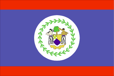
Pays/Territoires

Mise à jour 2021-01-12 18:58:07

La France est un pays situé en Europe dont la capitale est Paris. La hiérarchie des divisions administratives est la suivante : La France est subdivisée en régions, qui se divisent à leur tour en départements, qui se divisent à leur tour en cantons, qui se divisent à leur tour en communes, villes, qui se divisent à leur tour en villages, lieu-dit.

Les noms des pays/territoires du monde sont donnés en Français et Chinois. Cette collection des précieuses terres fermes du monde que toute l'humanité partage inclut non seulement les pays indépendants, mais aussi des régions spécifiques qui ne sont pas membre de l'ONUOrganisation des Nations Unies: Nous, peuples des Nations Unies ... Une ONU plus forte pour un monde meilleur. Veuillez aussi consulter les noms des pays en masculin et féminin en Français.

GéoPays    Fermer
France | Pays/Territoires | Régions en Chine | Provinces de Chine | Régions en France | Départements de France | Provinces du Monde | Villes/Villages | Localités | Continents du Monde | Vins AOP

1

id
Pays
Pays en Anglais
Argentina
Pays
Argentine
countryucasefr
ARGENTINE
Pays en Chinois
Pays en Espagnol
La Argentina
Pays en Italien
L'Argentina
Pays en Portugais
Argentina
Pays en Allemand
Argentinien
countrypy
a1 gen1 ting2
countrylocal
Argentina
countryfull
Argentina
countrynm
Argentina
ISO2
AR
ISO3
ARG
countrycodeisono
032
countrycodevehicle
RA
countrycodeolympic
ARG
countrycodeirs
AR
countrycodeirsfr
AR
countrycodeirsmixt
AR
countrycode
54
♀Féminin
15
7
131
languagesfr
Espagnol
8
currency
peso
currencyfr
peso
currencyisocode
ARS
currencyisocodefull
ARS 032
currencypxcode
ARS
currencysymbol
$
currencysubdivision
100 centavos
currencyregime
float
currencyvalue
0.3469
nationalityfr
Argentine
Capitale
Buenos Aires
capitalfr
Buenos Aires
Préfixe Tél.
54
Superficie km2
2 766 890
arealand
2 736 690
areawater
30 200
landarablerate
0.0914
landforestrate
0.127
coastline
4989
summit
Cerro Aconcagua 6 962 m
boundarycountries
Chili, Bolivie, Paraguay, Brésil, Uruguay
timezonedeltabegin
-3
flaglink
maplink
arcolor.gif
outlinemaplink
ar.gif
visapassenger
-1
maincities
Córdoba, Rosario, Mendoza, La Plata, Mar del Plata, San Miguel de Tucumán.
largestcity
Buenos Aires
largestcitypopulation
11 802 000
rankpopulation
31
Population
36 772 000
rankgdp
35
gdp
129596000000
rankgdpppp
22
gdpppp
445148000000
rankgni
30
gni
140139000000
rankincomeorigin
84
rankincome
93
income
3810
rankincomeppp
66
incomeppp
11410
lifeexpectation
75.5
alphabetizationrate
0.984
mortalityrateinfantile
0.0172
urbanization
0.603
precipitation
1147
nationalevent
Revolution Day
nationaleventfr
Jour de le Révolution
nationalholiday
25 May (1810)
Date de naissance aaaa-mm-jj
1810-05-25 00:00:00
7
7
location
Southern South America, bordering the South Atlantic Ocean, between Chile and Uruguay
terrain
rich plains of the Pampas in northern half, flat to rolling plateau of Patagonia in south, rugged Andes along western border
naturalresources
fertile plains of the Pampas, lead, zinc, tin, cop
cooking
Fruits exotiques.
9
Web
rgbback
16777215
todate
1
Notes
Fruits exotiques.

2

id
Pays
Pays en Anglais
Bahamas, The
Pays
Bahamas
countryucasefr
BAHAMAS
Pays en Chinois
Pays en Espagnol
Bahamas
Pays en Italien
Le Bahamas
Pays en Portugais
Bahamas
Pays en Allemand
Bahamas
countrypy
ba1 ha1 ma3
countrylocal
Bahamas
countryfull
Bahamas, The
countrynm
Bahamas, The
ISO2
BS
ISO3
BHS
countrycodeisono
044
countrycodevehicle
BS
countrycodeolympic
BAH
countrycodeirs
BF
countrycodeirsfr
BF
countrycodeirsmixt
BF
♀Féminin
20
6
51
languagesfr
Anglais
12
currency
dollar
currencyfr
dollar des Bahamas
currencyisocode
BSD
currencyisocodefull
BSD 044
currencypxcode
BSD
currencysymbol
B$
currencysubdivision
100 cents
currencyregime
US-$ (1.0)
currencyvalue
1.005
Capitale
Nassau
capitalfr
Nassau
Préfixe Tél.
1-242
Superficie km2
13 935
arealand
10 070
areawater
3 870
landarablerate
0.006
landforestrate
0.841
coastline
3542
summit
Mount Alvernia 63 m.
timezonedeltabegin
-5
flaglink
maplink
bscolor.gif
outlinemaplink
bs.gif
visapassenger
-1
maincities
Freeport, Nicolls Town, West End, Andros Town.
largestcity
Nassau
largestcitypopulation
195 000
rankpopulation
169
Population
317 000
rankgdp
116
gdp
5260000000
rankgdpppp
138
gdpppp
5291000000
rankgni
120
gni
4684000000
rankincomeorigin
41
rankincome
37
income
14920
rankincomeppp
54
incomeppp
16140
lifeexpectation
65.63
alphabetizationrate
0.9555
natalityrate
0.01822
fecondity
2.29
mortalityrate
0.00882
mortalityrateinfantile
0.0257
hdi
0.812
urbanization
0.889
precipitation
1360
nationalevent
Independence Day
nationaleventfr
Jour de l'Indépendance
nationalholiday
10 July (1973)
Date de naissance aaaa-mm-jj
1973-07-10 00:00:00
10
2
location
Caribbean, chain of islands in the North Atlantic Ocean, southeast of Florida, northeast of Cuba
terrain
long, flat coral formations with some low rounded hills
naturalresources
salt, aragonite, timber, arable land
9
Web
rgbback
16777215
todate
1

3

id
Pays
Pays en Anglais
Barbados
Pays
Barbade
countryucasefr
BARBADE
Pays en Chinois
Pays en Espagnol
Barbados
Pays en Italien
Le Barbados
Pays en Portugais
Barbados
Pays en Allemand
Barbados
countrypy
ba1 bei4 duo1
countrylocal
Barbados
countryfull
Barbados
countrynm
Barbados
ISO2
BB
ISO3
BRB
countrycodeisono
052
countrycodevehicle
BDS
countrycodeolympic
BAR
countrycodeirs
BB
countrycodeirsfr
BB
countrycodeirsmixt
BB
♀Féminin
18
6
51
languagesfr
Anglais
13
currency
dollar
currencyfr
dollar de la Barbade
currencyisocode
BBD
currencyisocodefull
BBD 052
currencypxcode
BBD
currencysymbol
Bds$
currencysubdivision
100 cents
currencyregime
US-$ (2.0)
currencyvalue
0.5128
Capitale
Bridgetown
capitalfr
Bridgetown
Préfixe Tél.
1-246
Superficie km2
430
arealand
431
landarablerate
0.3721
landforestrate
0.047
coastline
97
summit
Mount Hillaby 336 m.
timezonedeltabegin
-4
flaglink
maplink
bbcolor.gif
outlinemaplink
bb.gif
visapassenger
-1
maincities
Oistins, Holetown, Speightstown, Crab Hill, Hastings, Bathsheba.
largestcity
Bridgetown
largestcitypopulation
123 000
rankpopulation
173
Population
271 000
rankgdp
138
gdp
2627000000
rankgdpppp
145
gdpppp
4254000000
rankgni
146
gni
2507000000
rankincomeorigin
55
rankincome
59
income
9260
rankincomeppp
57
incomeppp
15060
lifeexpectation
71.64
alphabetizationrate
0.997
natalityrate
0.01298
fecondity
1.5
mortalityrate
0.00908
mortalityrateinfantile
0.01261
hdi
0.888
urbanization
0.504
nationalevent
Independence Day
nationaleventfr
Jour de l'Indépendance
nationalholiday
30 November (1966)
Date de naissance aaaa-mm-jj
1966-11-30 00:00:00
3
7
location
Caribbean, island in the North Atlantic Ocean, northeast of Venezuela
terrain
relatively flat; rises gently to central highland region
naturalresources
petroleum, fish, natural gas
9
Web
rgbback
16777215
todate
1

4

id
Pays
Pays en Anglais
Belize
Pays
Belize
countryucasefr
BELIZE
Pays en Chinois
Pays en Espagnol
Belice
Pays en Italien
Belize
Pays en Portugais
Belize
Pays en Allemand
Belize
countryfull
Belize
countrynm
Belize
ISO2
BZ
ISO3
BLZ
countrycodeisono
084
countrycodevehicle
BH
countrycodeolympic
BIZ
countrycodeirs
BH
countrycodeirsfr
BH
countrycodeirsmixt
BH
♂Masulin
18
6
51
languagesfr
Anglais
15
currency
dollar
currencyfr
dollar de Bélize
currencyisocode
BZD
currencyisocodefull
BZD 084
currencypxcode
BZD
currencysymbol
BZ$
currencysubdivision
100 cents
currencyregime
US-$ (2.0)
currencyvalue
0.5089
Capitale
Belmopan
capitalfr
Belmopan
Préfixe Tél.
501
Superficie km2
22 963
arealand
22 806
areawater
160
landarablerate
0.0281
landforestrate
0.591
coastline
386
summit
Victoria Peak 1 122 m.
boundarycountries
Guatémala, Mexique.
timezonedeltabegin
-6
flaglink
maplink
bzcolor.gif
outlinemaplink
bzoutl.gif
visapassenger
-1
maincities
Belize, Corozal, San Ignacio, Dangriga, Orange Walk.
largestcity
Belmopan
largestcitypopulation
6 000
rankpopulation
172
Population
274 000
rankgdp
155
gdp
988000000
rankgdpppp
153
gdpppp
1902000000
rankgni
174
gni
923000000
rankincomeorigin
88
rankincome
98
income
3370
rankincomeppp
98
incomeppp
6320
lifeexpectation
67.43
alphabetizationrate
0.937
natalityrate
0.02989
fecondity
3.15
mortalityrate
0.00604
mortalityrateinfantile
0.02637
growthrate
0.02385
hdi
0.776
urbanization
0.481
nationalevent
Independence Day
nationaleventfr
Jour de l'Indépendance
nationalholiday
21 September (1981)
Date de naissance aaaa-mm-jj
1981-09-21 00:00:00
8
10
location
Middle America, bordering the Caribbean Sea, between Guatemala and Mexico
terrain
flat, swampy coastal plain; low mountains in south
naturalresources
arable land potential, timber, fish, hydropower
9
Web
rgbback
16777215
todate
1

5

id
Pays
Pays en Anglais
Bolivia
Pays
Bolivie
countryucasefr
BOLIVIE
Pays en Chinois
Pays en Espagnol
Bolivia
Pays en Italien
La Bolivia
Pays en Portugais
Bolívia
Pays en Allemand
Bolivien
countrypy
bo1 li4 wei2 ya4
countrylocal
Bolivia
countryfull
Bolivia
countrynm
Bolivia
ISO2
BO
ISO3
BOL
countrycodeisono
068
countrycodevehicle
BOL
countrycodeolympic
BOL
countrycodeirs
BL
countrycodeirsfr
BL
countrycodeirsmixt
BL
countrycode
591
♀Féminin
15
6
131
languagesfr
Quechua, Espagnol, Aymara
17
currency
boliviano
currencyfr
boliviano
currencyisocode
BOB
currencyisocodefull
BOB 068
currencypxcode
BOB
currencysymbol
Bs
currencysubdivision
100 centavos
currencyregime
float
currencyvalue
0.1239
nationalityfr
Bolivienne
Capitale
La Paz
capitalfr
La Paz
Préfixe Tél.
591
Superficie km2
1 098 581
arealand
1 084 390
areawater
14 190
landarablerate
0.0173
landforestrate
0.489
summit
Cerro Illimani 6 882 m.
boundarycountries
Pérou, Brésil, Paraguay, Argentine, Chili.
timezonedeltabegin
-4
flaglink
maplink
bocolor.gif
outlinemaplink
bo.gif
visapassenger
-1
maincities
Cochabamba, Oruro, Santa Cruz, Sucre, Potosi.
largestcity
La Paz
largestcitypopulation
1 250 000
rankpopulation
81
Population
8 814 000
rankgdp
98
gdp
7867000000
rankgdpppp
96
gdpppp
22800000000
rankgni
99
gni
7924000000
rankincomeorigin
142
rankincome
155
income
900
rankincomeppp
151
incomeppp
2490
lifeexpectation
64.78
alphabetizationrate
0.8229
natalityrate
0.02553
mortalityrate
0.00791
mortalityrateinfantile
0.05605
hdi
0.643
nationalevent
Independence Day
nationaleventfr
Jour de l'Indépendance
nationalholiday
6 August (1825)
Date de naissance aaaa-mm-jj
1825-08-06 00:00:00
2
10
location
Central South America, southwest of Brazil
terrain
rugged Andes Mountains with a highland plateau (Altiplano), hills, lowland plains of the Amazon Basin
naturalresources
tin, natural gas, petroleum, zinc, tungsten, antim
9
Web
rgbback
16777215
todate
1

6

id
Pays
Pays en Anglais
Brazil
Pays
Brésil
countryucasefr
BRESIL
Pays en Chinois
Pays en Espagnol
El Brasil
Pays en Italien
Il Brasile
Pays en Portugais
Brasil
Pays en Allemand
Brasilien
countrypy
ba1 xi1
countrylocal
Brasil
countryfull
Brazil
countrynm
Brazil
ISO2
BR
ISO3
BRA
countrycodeisono
076
countrycodevehicle
BR
countrycodeolympic
BRA
countrycodeirs
BR
countrycodeirsfr
BR
countrycodeirsmixt
BR
countrycode
55
♂Masulin
17
6
114
languagesfr
Portugais
21
currency
real
currencyfr
real
currencyisocode
BRL
currencyisocodefull
BRL 986
currencypxcode
BRL
currencysymbol
R$
currencysubdivision
100 centavos
currencyregime
float
currencyvalue
0.4091
nationalityfr
Brésilienne
Capitale
Brasilia
capitalfr
Brasilia
Préfixe Tél.
55
Superficie km2
8 511 965
arealand
8 456 510
areawater
55 455
landarablerate
0.063
landforestrate
0.643
coastline
7491
summit
Pico de Neblina 3 014 m.
boundarycountries
Uruguay, Argentine, Bolivie, Paraguay, Pérou, Colombie, Vénézuéla, Guyane.
timezonedeltabegin
-2
timezonedeltaend
-5
flaglink
maplink
brcolor.gif
outlinemaplink
br.gif
visapassenger
-1
maincities
Sao Paulo, Rio de Janeiro, Belo Horizonte, Salvador, Fortaleza, Nova Iguaçu, Recife, Curitiba, Pôrto Alegre, Belém, Goiâna, Campinas.
largestcity
Sao Paulo
largestcitypopulation
16 533 000
rankpopulation
5
Population
176 596 000
rankgdp
15
gdp
492338000000
rankgdpppp
9
gdpppp
1375756000000
rankgni
13
gni
479515000000
rankincomeorigin
95
rankincome
105
income
2720
rankincomeppp
86
incomeppp
7510
lifeexpectation
71.41
alphabetizationrate
0.86
natalityrate
0.01725
mortalityrate
0.00614
mortalityrateinfantile
0.03066
hdi
0.777
nationalevent
Independence Day
nationaleventfr
Jour de l'Indépendance
nationalholiday
7 September (1822)
Date de naissance aaaa-mm-jj
1822-09-07 00:00:00
9
7
location
Eastern South America, bordering the Atlantic Ocean
terrain
mostly flat to rolling lowlands in north; some plains, hills, mountains, and narrow coastal belt
naturalresources
bauxite, gold, iron ore, manganese, nickel, phosph
cooking
Football + Cuisine Epicée.
9
Web
rgbback
16777215
todate
1
Notes
Football + Cuisine Epicée.

7

id
Pays
Pays en Anglais
Chile
Pays
Chili
countryucasefr
CHILI
Pays en Chinois
Pays en Espagnol
Chile
Pays en Italien
Il Cile
Pays en Portugais
O Chile
Pays en Allemand
Chile
countrypy
zhi4 li4
countrylocal
Chile
countryfull
Chile
countrynm
Chile
ISO2
CL
ISO3
CHL
countrycodeisono
152
countrycodevehicle
RCH
countrycodeolympic
CHI
countrycodeirs
CI
countrycodeirsfr
CI
countrycodeirsmixt
CL
countrycode
56
♂Masulin
15
6
131
languagesfr
Espagnol
27
currency
peso
currencyfr
peso
currencyisocode
CLP
currencyisocodefull
CLP 152
currencypxcode
CLP
currencysymbol
Ch$
currencysubdivision
100 centavos
currencyregime
indicators
currencyvalue
0.0017
nationalityfr
Chillienne
Capitale
Santiago
capitalfr
Santiago
Préfixe Tél.
56
Superficie km2
756 945
arealand
748 800
areawater
8 150
landarablerate
0.0265
landforestrate
0.207
coastline
6435
summit
Cerro Ojos del Salado 6 863 m.
boundarycountries
Pérou, Bolivie, Argentine.
timezonedeltabegin
-4
flaglink
maplink
clcolor.gif
outlinemaplink
cl.gif
visapassenger
-1
maincities
Viña del Mar, Valparaíso, Concepcíon, Talcahuano, Temuco, Antofagasta, Rancagua, Arica, Talca, Puerto Montt, Punta Arenas
largestcity
Santiago
largestcitypopulation
4 891 000
rankpopulation
58
Population
15 774 000
rankgdp
47
gdp
72415000000
rankgdpppp
44
gdpppp
162067000000
rankgni
46
gni
68733000000
rankincomeorigin
76
rankincome
83
income
4360
rankincomeppp
77
incomeppp
9810
lifeexpectation
76.35
alphabetizationrate
0.946
natalityrate
0.0161
mortalityrate
0.00563
mortalityrateinfantile
0.00888
hdi
0.826
nationalevent
Independence Day
nationaleventfr
Jour de l'Indépendance
nationalholiday
18 September (1810)
Date de naissance aaaa-mm-jj
1810-09-18 00:00:00
7
7
location
Southern South America, bordering the South Pacific Ocean, between Argentina and Peru
terrain
low coastal mountains; fertile central valley; rugged Andes in east
naturalresources
copper, timber, iron ore, nitrates, precious metal
cooking
Fruits de Mer
9
Web
rgbback
16777215
todate
1
Notes
Fruits de Mer

8

id
Pays
Pays en Anglais
Colombia
Pays
Colombie
countryucasefr
COLOMBIE
Pays en Chinois
Pays en Espagnol
Colombia
Pays en Italien
La Colombia
Pays en Portugais
Colômbia
Pays en Allemand
Kolumbien
countrypy
ge1 lun2 bi3 ya4
countrylocal
Colombia
countryfull
Colombia
countrynm
Colombia
ISO2
CO
ISO3
COL
countrycodeisono
170
countrycodevehicle
CO
countrycodeolympic
COL
countrycodeirs
CO
countrycodeirsfr
CO
countrycodeirsmixt
CO
countrycode
57
♀Féminin
15
6
131
languagesfr
Espagnol
28
currency
peso
currencyfr
peso
currencyisocode
COP
currencyisocodefull
COP 170
currencypxcode
COP
currencysymbol
Col$
currencysubdivision
100 centavos
currencyregime
m.float
currencyvalue
0.00043
nationalityfr
Colombienne
Capitale
Bogota
capitalfr
Bogota
Préfixe Tél.
57
Superficie km2
1 138 914
arealand
1 038 700
areawater
100 210
landarablerate
0.019
landforestrate
0.478
coastline
3208
summit
Pico Cristóbal Colón 5 775 m.
boundarycountries
Panama, Vénézuéla, Brésil, Pérou, Equateur.
timezonedeltabegin
-5
flaglink
maplink
cocolor.gif
outlinemaplink
co.gif
visapassenger
-1
maincities
Medellín, Cali, Barranquilla, Cartagena, Pereira, Cúcuta, Bucaramanga, Manizales
largestcity
Bogota
largestcitypopulation
6 079 000
rankpopulation
28
Population
44 584 000
rankgdp
46
gdp
78651000000
rankgdpppp
26
gdpppp
298799000000
rankgni
42
gni
80540000000
rankincomeorigin
118
rankincome
130
income
1810
rankincomeppp
97
incomeppp
6410
lifeexpectation
70.9
alphabetizationrate
0.867
natalityrate
0.0232
nationalevent
Independence Day
nationaleventfr
Jour de l'Indépendance
nationalholiday
20 July (1810)
Date de naissance aaaa-mm-jj
1810-07-20 00:00:00
7
7
location
Northern South America, bordering the Caribbean Sea, between Panama and Venezuela, and bordering the North Pacific Ocean, between Ecuador and Panama
terrain
flat coastal lowlands, central highlands, high Andes Mountains, eastern lowland plains
naturalresources
petroleum, natural gas, coal, iron ore, nickel, go
cooking
Fruits de Mer, Epices.
9
Web
rgbback
16777215
todate
1
Notes
Fruits de Mer, Epices.

9

id
Pays
Pays en Anglais
Costa Rica
Pays
Costa Rica
countryucasefr
COSTA RICA
Pays en Chinois
Pays en Espagnol
Costa Rica
Pays en Italien
Costa Rica
Pays en Portugais
Costa Rica
Pays en Allemand
Costa Rica
countrypy
ge1 si1 da4 li2 jia1
countrylocal
Costa Rica
countryfull
Costa Rica
countrynm
Costa Rica
ISO2
CR
ISO3
CRI
countrycodeisono
188
countrycodevehicle
CR
countrycodeolympic
CRC
countrycodeirs
CS
countrycodeirsfr
CS
countrycodeirsmixt
CS
countrycode
506
♀Féminin
15
6
131
languagesfr
Espagnol
29
currency
colon
currencyfr
Colon
currencyisocode
CRC
currencyisocodefull
CRC 188
currencypxcode
CRC
currencysymbol
slashed C
currencysubdivision
100 centimos
currencyregime
float
currencyvalue
0.00211
nationalityfr
Costa Ricaine
Capitale
San Jose
capitalfr
San Jose
Préfixe Tél.
506
Superficie km2
51 100
arealand
50 660
areawater
440
landarablerate
0.0441
landforestrate
0.385
coastline
1290
summit
Cerro Chirripó 3 819 m.
boundarycountries
Nicaragua, Panama.
timezonedeltabegin
-6
flaglink
maplink
crcolor.gif
outlinemaplink
croutl.gif
visapassenger
-1
maincities
Alajuela, Cartago, Limón, Puntarenas, Herdia, Liberia.
largestcity
San Jose
largestcitypopulation
920 000
rankpopulation
122
Population
4 005 000
rankgdp
79
gdp
17427000000
rankgdpppp
74
gdpppp
38469000000
rankgni
75
gni
17203000000
rankincomeorigin
77
rankincome
84
income
4300
rankincomeppp
79
incomeppp
9140
lifeexpectation
77.7
alphabetizationrate
0.928
natalityrate
0.0194
mortalityrate
0.00431
mortalityrateinfantile
0.01082
nationalevent
Independence Day
nationaleventfr
Jour de l'Indépendance
nationalholiday
15 September (1821)
Date de naissance aaaa-mm-jj
1821-09-15 00:00:00
8
6
location
Middle America, bordering both the Caribbean Sea and the North Pacific Ocean, between Nicaragua and Panama
terrain
coastal plains separated by rugged mountains including over 100 volcanic cones, of which several are major volcanoes
naturalresources
hydropower
cooking
Fruits de Mer
9
Web
rgbback
16777215
todate
1
Notes
Fruits de Mer

10

id
Pays
Pays en Anglais
Cuba
Pays
Cuba
countryucasefr
CUBA
Pays en Chinois
Pays en Espagnol
Cuba
Pays en Italien
La Cuba
Pays en Portugais
Cuba
Pays en Allemand
Kuba
countrypy
gu3 ba1
countrylocal
Cuba
countryfull
Cuba
countrynm
Cuba
ISO2
CU
ISO3
CUB
countrycodeisono
192
countrycodevehicle
CU
countrycodeolympic
CUB
countrycodeirs
CU
countrycodeirsfr
CU
countrycodeirsmixt
CU
5
1
131
languagesfr
Espagnol
31
currency
peso
currencyfr
peso cubain
currencyisocode
CUP
currencyisocodefull
CUP 192
currencypxcode
CUP
currencysymbol
Cu$
currencysubdivision
100 centavos
currencyregime
US-$ (1.0)
currencyvalue
0.04762
nationalityfr
Cubaine
Capitale
Havana
capitalfr
La Havane
Préfixe Tél.
53
Superficie km2
110 860
arealand
110 860
landarablerate
0.3304
landforestrate
0.214
coastline
3735
summit
Pico Turquino 1 994 m.
timezonedeltabegin
-5
flaglink
maplink
cuba.gif
visapassenger
-1
maincities
Santiago de Cuba, Camagüey, Holguín, Guantanámo, Santa Clara, Bayamo, Cienfuegos, Pinar del Rio, Las Tunas.
largestcity
Havana
largestcitypopulation
2 221 000
rankpopulation
68
Population
11 326 000
rankgni
86
gni
10600000000
rankincomeorigin
148
rankincome
151
income
942
lifeexpectation
75.5
alphabetizationrate
0.96
mortalityrate
0.0071
nationalevent
Independence Day
nationaleventfr
Jour de l'Indépendance
nationalholiday
10 December (1898)
Date de naissance aaaa-mm-jj
1898-12-10 00:00:00
5
11
location
Caribbean, island between the Caribbean Sea and the North Atlantic Ocean, 150 km south of Key West, Florida
terrain
mostly flat to rolling plains, with rugged hills and mountains in the southeast
naturalresources
cobalt, nickel, iron ore, copper, manganese, salt,
9
Web
rgbback
16777215
todate
1

Plus+
A | B | C | D | E | F | G | H | I | J | K | L | M | N | O | P | Q | R | S | T | U | V | W | X | Y | Z
 
Tous<=>Vivants::!Liste de Produits Filtrés!

Cuba | Pays/Territoires | Régions en Chine | Provinces de Chine | Régions en France | Départements de France | Provinces du Monde | Villes/Villages | Localités | Continents du Monde | Vins AOP

Envoyez vos commentaires (1)

1. Visiteur *.*.214.* - 2021-09-24 05:33:15
This is the first time I've ever heard that these countries aren't members of the UN. Thanks for the info and contact us in Chandler if you need the most reliable tree removal service.
Email Web

Veuillez recopier la chaîne :
Texte à recopier.

Asia Home™ > Boutique > France > Argentine 阿根廷 => Pays/Territoires | Conditions générales de vente | Retours et remboursements | Clauses de Confidentialité | FAQ
  

Envie de venir ? | Appelez-nous 7/704 67 79 04 87 (Service Epices)

Bonnes Fêtes ! Nouvel an Chinois Dans 6 jours !Bonnes Fêtes ! Nouvel an Chinois Dans 6 jours !
Fenêtre contextuelle    Fermer
Veuillez patienter...