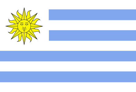
Countries/Territories

Updated 2021-01-12 18:58:07

France is a country on the continent Europe, her capital is Paris. Here is the hierarchy of the France administrative divisions: France is subdivided into regions, that are at their turn subdivided into departments, that are at their turn subdivided into cantons, that are at their turn subdivided into communes, cities, that are at their turn subdivided into villages, called-places.

The names of countries/territories of the world are taught in English and Chinese. This collection of precious dry lands that shares the whole mankind includes not only the world's independent countries, but also specific areas that are not a UNUnited Nations: We the peoples...A stronger UN for a better world. member. Please visit the table of male and female genders of country names in French.

In French, country names have their male and female gender. The majority of young countries have their name in male form just as Ouganda, Congo. But historical countries have their gender according to the termination of the word. La Chine is female as the majority of European Coutries except for Andorre, Chypre, Malte, Monaco, Saint-Marin, le Danemark, le Luxembourg, le Liechtenstein, le Monténégro. les Pays-Bas, le Portugal et le Vatican (cf. Noms Pays masculins féminins).

So the gender column will be presented as follows: ♂Male, ♀Female, Neutral.

Countries/locations    Close
France | Countries/Territories | Regions of China | Provinces of China | Regions in France | French Departments | States/Provinces | Cities/Towns | Locations | World Continents | French AOP Wines

31

id
Country
Country
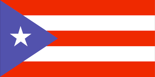
Puerto Rico
Country in French
Porto Rico
countryucasefr
PORTO RICO
Country in Chinese
Country in Spanish
Puerto Rico
Country in Italian
Puerto Rico
Country in Portuguese
Puerto Rico
Country in Germain
Puerto Rico
countrypy
bo1 duo1 li2 ge4
countrylocal
Puerto Rico
countryfull
Puerto Rico
countrynm
Puerto Rico
ISO2
PR
ISO3
PRI
countrycodeisono
630
countrycodeolympic
PUR
countrycodeirs
RQ
countrycodeirsfr
RQ
countrycodeirsmixt
RQ
countrycode
1809
12
6
131
languagesfr
Espagnol
6
currency
dollar
currencyfr
dollar
currencyisocode
USD
currencyisocodefull
USD 840
currencypxcode
USD
currencysymbol
$
currencysubdivision
100 cents
currencyregime
float
currencyvalue
1
nationalityfr
Porto Ricaine
Capital
San Juan
capitalfr
San Juan
Phone Prefix
1-787
Area km2
9 104
arealand
8 959
areawater
145
landarablerate
0.0372
landforestrate
0.258
coastline
501
summit
Cerro de Punta 1 338 m.
timezonedeltabegin
-4
flaglink
maplink
prcolor.gif
outlinemaplink
pr.gif
visapassenger
-1
maincities
Bayamón, Ponce, Carolina, Caguas, Mayagüez, Arecibo, Guaynabo, Toa Baja, Trujillo, Aguadilla, Cayey, Guayama.
largestcity
San Juan
largestcitypopulation
1 988 584
rankpopulation
124
Population
3 898 000
rankgdp
49
gdp
67897000000
rankgdpppp
56
gdpppp
95613000000
rankgni
55
gni
42057000000
rankincomeorigin
52
rankincome
54
income
10950
rankincomeppp
52
incomeppp
16210
lifeexpectation
77.26
alphabetizationrate
0.891
natalityrate
0.015
mortalityrate
0.00768
mortalityrateinfantile
0.00938
nationalevent
US Independence Day
nationaleventfr
Jour de l'Indépendance
nationalholiday
4 July (1776)
Birthday yyyy-mm-dd
1776-07-04 00:00:00
3
9
location
Caribbean, island between the Caribbean Sea and the North Atlantic Ocean, east of the Dominican Republic
terrain
mostly mountains, with coastal plain belt in north; mountains precipitous to sea on west coast; sandy beaches along most coastal areas
naturalresources
some copper and nickel; potential for onshore and
9
Web
rgbback
16777215
todate
1

32

id
Country
Country
South Georgia and the South Sandwich Islands
Country in French
Georgie du Sud
countryucasefr
GEORGIE DU SUD
Country in Chinese
Country in Spanish
Georgia Del sur
Country in Italian
Georgia Del sud
Country in Portuguese
Geórgia Sul
Country in Germain
SüdcGeorgia
countryfull
South Georgia and the South Sandwich Islands
countrynm
South Georgia and the South Sandwich Islands
ISO2
GS
ISO3
SGS
countrycodeisono
239
countrycodeirs
SX
countrycodeirsfr
SX
countrycodeirsmixt
SX
♀Female
12
6
51
22
currencypxcode
GBP
nationalityfr
Georgienne
Capital
Grytviken
capitalfr
Grytviken
Area km2
4 066
arealand
3 903
timezonedeltabegin
-2
flaglink
maplink
sx-map.jpg
visapassenger
-1
largestcity
Grytviken
rankincome
222
nationalevent
Liberation Day
nationaleventfr
Jour de la Libération
nationalholiday
14 June (1982)
Birthday yyyy-mm-dd
1982-06-14 00:00:00
9
11
location
Southern South America, islands in the South Atlantic Ocean, east of the tip of South America
terrain
most of the islands, rising steeply from the sea, are rugged and mountainous; South Georgia is largely barren and has steep, glacier-covered mountains; the South Sandwich Islands are of volcanic origin with some active volcanoes
naturalresources
fish
cooking
A group of British-administered volcanic islands in the southern Atlantic Ocean east-southeast of Cape Horn. Part of the Falkland Islands Dependency, the islands were discovered in 1775.
7
rgbback
16777215
todate
1

33

id
Country
Country
Saint Kitts and Nevis
Country in French
Saint-Christophe-et-Niévès
countryucasefr
SAINT-CHRISTOPHE-ET-NIEVES
Country in Chinese
Country in Spanish
St. Kitts y Nevis
Country in Italian
St Kitts e Nevis
Country in Portuguese
St. Kitts e Nevis
Country in Germain
Str. Kitts und Nevis
countrypy
sheng4 ji1 ci2 he2 ni2 wei2 si1
countrylocal
Saint Kitts and Nevis
countryfull
Saint Kitts and Nevis
countrynm
Saint Kitts and Nevis
ISO2
KN
ISO3
KNA
countrycodeisono
659
countrycodeolympic
SKN
countrycodeirs
SC
countrycodeirsfr
SC
countrycodeirsmixt
SC
♂Male
12
6
51
languagesfr
Anglais
35
currency
dollar
currencyfr
dollar des Caraïbes oriental
currencyisocode
XCD
currencyisocodefull
XCD 951
currencypxcode
XCD
currencysymbol
EC$
currencysubdivision
100 cents
currencyregime
US-$ (2.7)
currencyvalue
0.3745
Capital
Basseterre
capitalfr
Basseterre
Phone Prefix
1-869
Area km2
261
arealand
261
landarablerate
0.1667
landforestrate
0.111
coastline
135
summit
Mount Liamuiga 1 156 m.
timezonedeltabegin
-4
flaglink
maplink
kncolor.gif
outlinemaplink
kn.gif
visapassenger
-1
maincities
Charlestown, Newcastle, Sandy Point .
largestcity
Basse-Terre
largestcitypopulation
12 000
rankpopulation
202
Population
47 000
rankgdp
172
gdp
346000000
rankgdpppp
165
gdpppp
579000000
rankgni
196
gni
309000000
rankincomeorigin
65
rankincome
72
income
6630
rankincomeppp
70
incomeppp
10740
nationalevent
Independence Day
nationaleventfr
Jour de l'Indépendance
nationalholiday
19 September (1983)
Birthday yyyy-mm-dd
1983-09-19 00:00:00
10
12
location
Caribbean, islands in the Caribbean Sea, about one-third of the way from Puerto Rico to Trinidad and Tobago
terrain
volcanic with mountainous interiors
naturalresources
arable land
9
Web
rgbback
16777215
todate
1

34

id
Country
Country
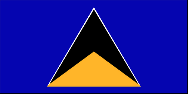
Saint Lucia
Country in French
Sainte-Lucie
countryucasefr
SAINTE-LUCIE
Country in Chinese
Country in Spanish
St. Lucia
Country in Italian
St Lucia
Country in Portuguese
St. Lucia
Country in Germain
Str. Lucia
countrypy
sheng4 lu2 xi1 ya4
countrylocal
Saint Lucia
countryfull
Saint Lucia
countrynm
Saint Lucia
ISO2
LC
ISO3
LCA
countrycodeisono
662
countrycodevehicle
WL
countrycodeolympic
LCA
countrycodeirs
ST
countrycodeirsfr
ST
countrycodeirsmixt
ST
♀Female
18
6
51
languagesfr
Anglais
35
currency
dollar
currencyfr
dollar des Caraïbes orientales
currencyisocode
XCD
currencyisocodefull
XCD 951
currencypxcode
XCD
currencysymbol
EC$
currencysubdivision
100 cents
currencyregime
US-$ (2.7)
currencyvalue
0.3745
Capital
Castries
capitalfr
Castries
Phone Prefix
1-758
Area km2
620
arealand
606
areawater
10
landarablerate
0.0492
landforestrate
0.148
coastline
158
summit
Mont Gimie 950 m.
timezonedeltabegin
-4
flaglink
maplink
lccolor.gif
outlinemaplink
lc.gif
visapassenger
-1
maincities
Vieux Fort, Dennery, Micoud, Soufrière.
largestcity
Castries
largestcitypopulation
53 000
rankpopulation
181
Population
161 000
rankgdp
165
gdp
693000000
rankgdpppp
158
gdpppp
917000000
rankgni
184
gni
650000000
rankincomeorigin
80
rankincome
88
income
4050
rankincomeppp
114
incomeppp
5310
lifeexpectation
73.34
alphabetizationrate
0.67
natalityrate
0.0205
fecondity
2.27
mortalityrate
0.00518
mortalityrateinfantile
0.01395
hdi
0.775
urbanization
0.38
nationalevent
Independence Day
nationaleventfr
Jour de l'Indépendance
nationalholiday
22 February (1979)
Birthday yyyy-mm-dd
1979-02-22 00:00:00
6
8
president
Reine Elisabeth II
location
Caribbean, island between the Caribbean Sea and North Atlantic Ocean, north of Trinidad and Tobago
terrain
volcanic and mountainous with some broad, fertile valleys
naturalresources
forests, sandy beaches, minerals (pumice), mineral
9
Web
rgbback
16777215
todate
1

35

id
Country
Country
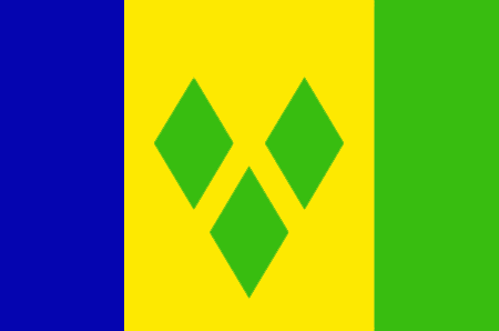
Saint Vincent and the Grenadines
Country in French
Saint-Vincent-et-les Grenadines
countryucasefr
SAINT-VINCENT-ET-LES GRENADINES
Country in Chinese
Country in Spanish
St. Vincent y el Grenadines
Country in Italian
St Vincent & il Grenadines
Country in Portuguese
St. Vincent & o Grenadines
Country in Germain
Str. Vincent u. das Grenadines
countrypy
sheng4 wen2 sen1 te4 he2 ge2 lin2 na4 ding1 si1
countrylocal
Saint Vincent and the Grenadines
countryfull
Saint Vincent and the Grenadines
countrynm
Saint Vincent and the Grenadines
ISO2
VC
ISO3
VCT
countrycodeisono
670
countrycodevehicle
WV
countrycodeolympic
VIN
countrycodeirs
VC
countrycodeirsfr
VC
countrycodeirsmixt
VC
18
6
51
languagesfr
Anglais
35
currency
dollar
currencyfr
dollar des Caraïbes orientales
currencyisocode
XCD
currencyisocodefull
XCD 951
currencypxcode
XCD
currencysymbol
EC$
currencysubdivision
100 cents
currencyregime
US-$ (2.7)
currencyvalue
0.3745
nationalityfr
Française
Capital
Kingstown
capitalfr
Kingstown
Phone Prefix
1-784
Area km2
389
arealand
389
landarablerate
0.1026
landforestrate
0.154
coastline
84
summit
Soufrière 1 234 m.
timezonedeltabegin
-4
flaglink
maplink
vccolor.gif
outlinemaplink
vc.gif
visapassenger
-1
maincities
Georgetown, Fancy, Chateaubelair, Layou.
largestcity
Kingstown
largestcitypopulation
27 000
rankpopulation
186
Population
109 000
rankgdp
171
gdp
371000000
rankgdpppp
163
gdpppp
668000000
rankgni
192
gni
361000000
rankincomeorigin
91
rankincome
101
income
3310
rankincomeppp
105
incomeppp
5870
lifeexpectation
73.35
alphabetizationrate
0.96
natalityrate
0.01677
fecondity
2.23
mortalityrate
0.00604
mortalityrateinfantile
0.01524
hdi
0.755
urbanization
0.56
nationalevent
Independence Day
nationaleventfr
Jour de l'Indépendance
nationalholiday
27 October (1979)
Birthday yyyy-mm-dd
1979-10-27 00:00:00
6
8
location
Caribbean, islands between the Caribbean Sea and North Atlantic Ocean, north of Trinidad and Tobago
terrain
volcanic, mountainous
naturalresources
hydropower, cropland
9
Web
rgbback
16777215
todate
1

36

id
Country
Country
Suriname
Country in French
Suriname
countryucasefr
SURINAME
Country in Chinese
Country in Spanish
Suriname
Country in Italian
Il Surinam
Country in Portuguese
Surinam
Country in Germain
Surinam
countrypy
su1 li3 nan2
countrylocal
Suriname
countryfull
Suriname
countrynm
Suriname
ISO2
SR
ISO3
SUR
countrycodeisono
740
countrycodevehicle
SME
countrycodeolympic
SUR
countrycodeirs
NS
countrycodeirsfr
NS
countrycodeirsmixt
NS
♂Male
19
6
24
languagesfr
Néerlandais
100
currency
Dollar
currencyfr
Florin du Surinam
currencyisocode
SRD
currencyisocodefull
SRD 740
currencypxcode
SRD
currencysymbol
$Sur
currencysubdivision
100 cents
currencyregime
m.float
currencyvalue
0.39962
nationalityfr
Surinamienne
Capital
Paramaribo
capitalfr
Paramaribo
Phone Prefix
597
Area km2
163 265
arealand
161 470
areawater
1 800
landarablerate
0.0037
landforestrate
0.905
coastline
386
summit
Wilhelmina Gebergte 1 286 m.
boundarycountries
Guyana, Guyane, Brésil.
timezonedeltabegin
-3
flaglink
maplink
srcolor.gif
outlinemaplink
sr.gif
visapassenger
-1
maincities
Nieuw Nickerie, Marienburg, Moengo, Totness.
largestcity
Paramaribo
largestcitypopulation
112 000
rankpopulation
166
Population
438 000
rankgdp
152
gdp
1154000000
rankgni
173
gni
998000000
rankincomeorigin
101
rankincome
111
income
2280
lifeexpectation
69.1
alphabetizationrate
0.9425
natalityrate
0.01887
mortalityrate
0.00699
mortalityrateinfantile
0.02415
hdi
0.762
urbanization
0.748
nationalevent
Independence Day
nationaleventfr
Jour de l'Indépendance
nationalholiday
25 November (1975)
Birthday yyyy-mm-dd
1975-11-25 00:00:00
2
4
location
Northern South America, bordering the North Atlantic Ocean, between French Guiana and Guyana
terrain
mostly rolling hills; narrow coastal plain with swamps
naturalresources
timber, hydropower, fish, kaolin, shrimp, bauxite,
cooking
Fruits de Mer
9
Web
rgbback
16777215
todate
1
Notes
Fruits de Mer

37

id
Country
Country
Trinidad and Tobago
Country in French
Trinité-et-Tobago
countryucasefr
TRINITE-ET-TOBAGO
Country in Chinese
Country in Spanish
Trinidad y Trinidad y Tobago
Country in Italian
La Trinidad ed il Tobago
Country in Portuguese
Trinidad e tobago
Country in Germain
Trinidad und Tobago
countrypy
te4 li4 ni2 da2 he2 duo1 ba1 ge1
countrylocal
Trinidad and Tobago
countryfull
Trinidad and Tobago
countrynm
Trinidad and Tobago
ISO2
TT
ISO3
TTO
countrycodeisono
780
countrycodevehicle
TT
countrycodeolympic
TRI
countrycodeirs
TD
countrycodeirsfr
TD
countrycodeirsmixt
TD
18
6
51
languagesfr
Anglais
104
currency
dollar
currencyfr
dollar de la Trinité
currencyisocode
TTD
currencyisocodefull
TTD 780
currencypxcode
TTD
currencysymbol
TT$
currencysubdivision
100 cents
currencyregime
float
currencyvalue
0.1613
Capital
Port-of-Spain
capitalfr
Port of Spain
Phone Prefix
1-868
Area km2
5 128
arealand
5 128
landarablerate
0.1462
landforestrate
0.505
coastline
362
summit
El Cerro del Aripo 940 m.
timezonedeltabegin
-4
flaglink
maplink
tt.jpg
outlinemaplink
trintbgo.gif
visapassenger
-1
maincities
San Fernando, Arima, Scarborough .
largestcity
Port of Spain
largestcitypopulation
52 000
rankpopulation
149
Population
1 313 000
rankgdp
92
gdp
10511000000
rankgdpppp
111
gdpppp
14132000000
rankgni
90
gni
10220000000
rankincomeorigin
60
rankincome
66
income
7790
rankincomeppp
74
incomeppp
10390
lifeexpectation
69.28
alphabetizationrate
0.985
natalityrate
0.01275
mortalityrate
0.00902
mortalityrateinfantile
0.02464
hdi
0.802
urbanization
0.745
precipitation
1870
nationalevent
Independence Day
nationaleventfr
Jour de l'Indépendance
nationalholiday
31 August (1962)
Birthday yyyy-mm-dd
1962-08-31 00:00:00
9
3
location
Caribbean, islands between the Caribbean Sea and the North Atlantic Ocean, northeast of Venezuela
terrain
mostly plains with some hills and low mountains
naturalresources
petroleum, natural gas, asphalt
9
Web
rgbback
16777215
todate
1

38

id
Country
Country
Uruguay
Country in French
Uruguay
countryucasefr
URUGUAY
Country in Chinese
Country in Spanish
Uruguay
Country in Italian
L'Uruguai
Country in Portuguese
Uruguai
Country in Germain
Uruguay
countrypy
wu1 la1 gui1
countrylocal
Republica Oriental del Uruguay
countryfull
Uruguay
countrynm
Uruguay
ISO2
UY
ISO3
URY
countrycodeisono
858
countrycodevehicle
ROU
countrycodeolympic
URU
countrycodeirs
UY
countrycodeirsfr
UY
countrycodeirsmixt
UY
countrycode
598
♂Male
15
6
131
languagesfr
Espagnol
109
currency
peso uruguayo
currencyfr
peso uruguayen
currencyisocode
UYU
currencyisocodefull
UYU 858
currencypxcode
UYP
currencysymbol
$U
currencysubdivision
100 centésimos
currencyregime
m.float
currencyvalue
0.04158
nationalityfr
Uruguayenne
Capital
Montevideo
capitalfr
Montévideo
Phone Prefix
598
Area km2
176 215
arealand
173 620
areawater
2 600
landarablerate
0.0721
landforestrate
0.074
coastline
660
summit
Cerro Catedral 514 m.
boundarycountries
Argentine, Brésil.
timezonedeltabegin
-3
flaglink
maplink
uycolor.gif
outlinemaplink
uy.gif
visapassenger
-1
maincities
Salto, Paysandú, Las Piedras, Rivera, Melo, Tacuarembó, Mercedes, Minas.
largestcity
Montevideo
largestcitypopulation
1 325 000
rankpopulation
128
Population
3 380 000
rankgdp
88
gdp
11182000000
rankgdpppp
87
gdpppp
27987000000
rankgni
83
gni
12904000000
rankincomeorigin
83
rankincome
92
income
3820
rankincomeppp
84
incomeppp
7980
lifeexpectation
75.38
alphabetizationrate
0.969
natalityrate
0.01572
mortalityrate
0.00935
mortalityrateinfantile
0.01231
hdi
0.834
urbanization
0.921
precipitation
1102
nationalevent
Independence Day
nationaleventfr
Jour de l'Indépendance
nationalholiday
25 August (1825)
Birthday yyyy-mm-dd
1825-08-25 00:00:00
2
10
location
Southern South America, bordering the South Atlantic Ocean, between Argentina and Brazil
terrain
mostly rolling plains and low hills; fertile coastal lowland
naturalresources
arable land, hydropower, minor minerals, fisheries
9
Web
rgbback
16777215
todate
1

39

id
Country
Country
Venezuela
Country in French
Venezuela
countryucasefr
VENEZUELA
Country in Chinese
Country in Spanish
Venezuela
Country in Italian
Il Venezuela
Country in Portuguese
Venezuela
Country in Germain
Venezuela
countrypy
wei3 nei4 rui4 la1
countrylocal
Venezuela
countryfull
Venezuela
countrynm
Venezuela
ISO2
VE
ISO3
VEN
countrycodeisono
862
countrycodevehicle
YV
countrycodeolympic
VEN
countrycodeirs
VE
countrycodeirsfr
VE
countrycodeirsmixt
VE
countrycode
58
♂Male
4
131
languagesfr
Espagnol
111
currency
bolivar
currencyfr
bolivar
currencyisocode
VEB
currencyisocodefull
VEB 862
currencypxcode
VEB
currencysymbol
Bs
currencysubdivision
100 centimos
currencyregime
float
currencyvalue
0.00047
nationalityfr
Vénézulienne
Capital
Caracas
capitalfr
Caracas
Phone Prefix
58
Area km2
912 050
arealand
882 050
areawater
30 000
landarablerate
0.0299
landforestrate
0.561
coastline
2800
summit
Pico Bolivar 5 002 m.
boundarycountries
Colombie, Guyana, Brésil.
timezonedeltabegin
-4
flaglink
maplink
vecolor.gif
outlinemaplink
ve.gif
visapassenger
-1
maincities
Maracaibo, Valencia, Maracay, Barquisimeto, Ciudad Guyana, San Cristóbal, Ciudad Bolivar, Maturín, Mérida, Cumana, Barcelona, Cabimas
largestcity
Caracas
largestcitypopulation
3 007 000
rankpopulation
39
Population
25 674 000
rankgdp
40
gdp
85394000000
rankgdpppp
52
gdpppp
126279000000
rankgni
40
gni
89665000000
rankincomeorigin
87
rankincome
97
income
3490
rankincomeppp
125
incomeppp
4750
lifeexpectation
73.81
alphabetizationrate
0.9069
natalityrate
0.01978
mortalityrate
0.0049
mortalityrateinfantile
0.02379
precipitation
916
nationalevent
Independence Day
nationaleventfr
Jour de l'Indépendance
nationalholiday
5 July (1811)
Birthday yyyy-mm-dd
1811-07-05 00:00:00
8
8
location
Northern South America, bordering the Caribbean Sea and the North Atlantic Ocean, between Colombia and Guyana
terrain
Andes Mountains and Maracaibo Lowlands in northwest; central plains (llanos); Guiana Highlands in southeast
naturalresources
petroleum, natural gas, iron ore, gold, bauxite, o
9
Web
rgbback
16777215
todate
1

40

id
Country
Country
Virgin Islands
Country in French
Vierges/Américaines (îles)
countryucasefr
VIERGES/AMERICAINES (ILES)
Country in Chinese
Country in Spanish
Islas De la Virgen (los E.E.U.U.)
Country in Italian
Le Isole Vergini (Stati Uniti)
Country in Portuguese
Consoles Do Virgin (E. U.)
Country in Germain
JungfraucInseln (US)
countryfull
Virgin Islands
countrynm
Virgin Islands
ISO2
VI
ISO3
VIR
countrycodeisono
850
countrycodeolympic
ISV
countrycodeirs
VQ
countrycodeirsfr
VQ
countrycodeirsmixt
VQ
♀Female
17
6
51
languagesfr
Anglais
6
currency
dollar
currencyfr
dollar
currencyisocode
USD
currencyisocodefull
USD 840
currencypxcode
USD
currencysymbol
$
currencysubdivision
100 cents
currencyregime
float
currencyvalue
1
nationalityfr
Américaine
Capital
Charlotte Amalie
capitalfr
Charlotte Amalie
Phone Prefix
1-340
Area km2
352
arealand
349
areawater
3
landarablerate
0.15
landforestrate
0.412
coastline
188
summit
Crown Mountain 474 m.
timezonedeltabegin
-4
flaglink
maplink
vicolor.gif
outlinemaplink
vi.gif
visapassenger
-1
maincities
Frederiksted, Christiansted, Cruz Bay.
largestcity
Charlotte Amalie
rankpopulation
185
Population
125 000
rankgni
148
gni
1960000000
rankincomeorigin
31
rankincome
32
income
16752
lifeexpectation
78.75
natalityrate
0.01449
fecondity
2.21
mortalityrate
0.0061
mortalityrateinfantile
0.00821
growthrate
-0.00054
nationalevent
Transfer Day (from Denmark to the US)
nationaleventfr
Jour du Transfert de Danemark aux Etats-Unis d'Amérique
nationalholiday
27 March (1917)
Birthday yyyy-mm-dd
1917-03-27 00:00:00
4
6
location
Caribbean, islands between the Caribbean Sea and the North Atlantic Ocean, east of Puerto Rico
terrain
mostly hilly to rugged and mountainous with little level land
naturalresources
sun, sand, sea, surf
9
Web
rgbback
16777215
todate
1

More+
A | B | C | D | E | F | G | H | I | J | K | L | M | N | O | P | Q | R | S | T | U | V | W | X | Y | Z
 

China | Countries/Territories | Regions of China | Provinces of China | Regions in France | French Departments | States/Provinces | Cities/Towns | Locations | World Continents | French AOP Wines

Give us feedback (0)

No any user feedback.
Email Web

Please copy the string:
String to copy.

Asia Home™ > Store > France > Puerto Rico 波多黎各 => Countries/Territories | General Sales Conditions | Returns and refunding | Privacy Policy | FAQ
  

Want to come? | Call us 7/700 33 467 790 487 (Phone)

Popup Window    Close
Patience please...