Indonésie 印度尼西亚 => Pays de Beau Bois

Indonésie 印度尼西亚 => Pays de Beau Bois


Les artisans

Sélection des meubles indonésiens

Les objets

Histoire des meubles indonésiens

Indonésie 印度尼西亚 => Pays de Beau Bois

Mise à jour 2023-11-09 09:24:11

L'Indonésie est un pays situé en Asie dont la capitale est Jakarta. La hiérarchie des divisions administratives est la suivante : L'Indonésie est subdivisée en provinces, qui se divisent à leur tour en régences (kabupaten), villes (kota), qui se divisent à leur tour en districts, qui se divisent à leur tour en bourgades, villages.

Les noms des pays/territoires du monde sont donnés en Français et Chinois. Cette collection des précieuses terres fermes du monde que toute l'humanité partage inclut non seulement les pays indépendants, mais aussi des régions spécifiques qui ne sont pas membre de l'ONUOrganisation des Nations Unies: Nous, peuples des Nations Unies ... Une ONU plus forte pour un monde meilleur. Veuillez aussi consulter les noms des pays en masculin et féminin en Français.

GéoPays    Fermer
Indonésie | Pays/Territoires | Régions en Chine | Provinces de Chine | Régions en France | Départements de France | Provinces du Monde | Villes/Villages | Localités | Continents du Monde | Vins AOP

31

id
Pays
Pays en Anglais
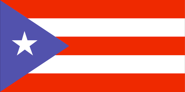
Puerto Rico
Pays
Porto Rico
countryucasefr
PORTO RICO
Pays en Chinois
Pays en Espagnol
Puerto Rico
Pays en Italien
Puerto Rico
Pays en Portugais
Puerto Rico
Pays en Allemand
Puerto Rico
countrypy
bo1 duo1 li2 ge4
countrylocal
Puerto Rico
countryfull
Puerto Rico
countrynm
Puerto Rico
ISO2
PR
ISO3
PRI
countrycodeisono
630
countrycodeolympic
PUR
countrycodeirs
RQ
countrycodeirsfr
RQ
countrycodeirsmixt
RQ
countrycode
1809
12
6
131
languagesfr
Espagnol
6
currency
dollar
currencyfr
dollar
currencyisocode
USD
currencyisocodefull
USD 840
currencypxcode
USD
currencysymbol
$
currencysubdivision
100 cents
currencyregime
float
currencyvalue
1
nationalityfr
Porto Ricaine
Capitale
San Juan
capitalfr
San Juan
Préfixe Tél.
1-787
Superficie km2
9 104
arealand
8 959
areawater
145
landarablerate
0.0372
landforestrate
0.258
coastline
501
summit
Cerro de Punta 1 338 m.
timezonedeltabegin
-4
flaglink
maplink
prcolor.gif
outlinemaplink
pr.gif
visapassenger
-1
maincities
Bayamón, Ponce, Carolina, Caguas, Mayagüez, Arecibo, Guaynabo, Toa Baja, Trujillo, Aguadilla, Cayey, Guayama.
largestcity
San Juan
largestcitypopulation
1 988 584
rankpopulation
124
Population
3 898 000
rankgdp
49
gdp
67897000000
rankgdpppp
56
gdpppp
95613000000
rankgni
55
gni
42057000000
rankincomeorigin
52
rankincome
54
income
10950
rankincomeppp
52
incomeppp
16210
lifeexpectation
77.26
alphabetizationrate
0.891
natalityrate
0.015
mortalityrate
0.00768
mortalityrateinfantile
0.00938
nationalevent
US Independence Day
nationaleventfr
Jour de l'Indépendance
nationalholiday
4 July (1776)
Date de naissance aaaa-mm-jj
1776-07-04 00:00:00
3
9
location
Caribbean, island between the Caribbean Sea and the North Atlantic Ocean, east of the Dominican Republic
terrain
mostly mountains, with coastal plain belt in north; mountains precipitous to sea on west coast; sandy beaches along most coastal areas
naturalresources
some copper and nickel; potential for onshore and
9
Web
rgbback
16777215
todate
1

32

id
Pays
Pays en Anglais
South Georgia and the South Sandwich Islands
Pays
Georgie du Sud
countryucasefr
GEORGIE DU SUD
Pays en Chinois
Pays en Espagnol
Georgia Del sur
Pays en Italien
Georgia Del sud
Pays en Portugais
Geórgia Sul
Pays en Allemand
SüdcGeorgia
countryfull
South Georgia and the South Sandwich Islands
countrynm
South Georgia and the South Sandwich Islands
ISO2
GS
ISO3
SGS
countrycodeisono
239
countrycodeirs
SX
countrycodeirsfr
SX
countrycodeirsmixt
SX
♀Féminin
12
6
51
22
currencypxcode
GBP
nationalityfr
Georgienne
Capitale
Grytviken
capitalfr
Grytviken
Superficie km2
4 066
arealand
3 903
timezonedeltabegin
-2
flaglink
maplink
sx-map.jpg
visapassenger
-1
largestcity
Grytviken
rankincome
222
nationalevent
Liberation Day
nationaleventfr
Jour de la Libération
nationalholiday
14 June (1982)
Date de naissance aaaa-mm-jj
1982-06-14 00:00:00
9
11
location
Southern South America, islands in the South Atlantic Ocean, east of the tip of South America
terrain
most of the islands, rising steeply from the sea, are rugged and mountainous; South Georgia is largely barren and has steep, glacier-covered mountains; the South Sandwich Islands are of volcanic origin with some active volcanoes
naturalresources
fish
cooking
A group of British-administered volcanic islands in the southern Atlantic Ocean east-southeast of Cape Horn. Part of the Falkland Islands Dependency, the islands were discovered in 1775.
7
rgbback
16777215
todate
1

33

id
Pays
Pays en Anglais
Saint Kitts and Nevis
Pays
Saint-Christophe-et-Niévès
countryucasefr
SAINT-CHRISTOPHE-ET-NIEVES
Pays en Chinois
Pays en Espagnol
St. Kitts y Nevis
Pays en Italien
St Kitts e Nevis
Pays en Portugais
St. Kitts e Nevis
Pays en Allemand
Str. Kitts und Nevis
countrypy
sheng4 ji1 ci2 he2 ni2 wei2 si1
countrylocal
Saint Kitts and Nevis
countryfull
Saint Kitts and Nevis
countrynm
Saint Kitts and Nevis
ISO2
KN
ISO3
KNA
countrycodeisono
659
countrycodeolympic
SKN
countrycodeirs
SC
countrycodeirsfr
SC
countrycodeirsmixt
SC
♂Masulin
12
6
51
languagesfr
Anglais
35
currency
dollar
currencyfr
dollar des Caraïbes oriental
currencyisocode
XCD
currencyisocodefull
XCD 951
currencypxcode
XCD
currencysymbol
EC$
currencysubdivision
100 cents
currencyregime
US-$ (2.7)
currencyvalue
0.3745
Capitale
Basseterre
capitalfr
Basseterre
Préfixe Tél.
1-869
Superficie km2
261
arealand
261
landarablerate
0.1667
landforestrate
0.111
coastline
135
summit
Mount Liamuiga 1 156 m.
timezonedeltabegin
-4
flaglink
maplink
kncolor.gif
outlinemaplink
kn.gif
visapassenger
-1
maincities
Charlestown, Newcastle, Sandy Point .
largestcity
Basse-Terre
largestcitypopulation
12 000
rankpopulation
202
Population
47 000
rankgdp
172
gdp
346000000
rankgdpppp
165
gdpppp
579000000
rankgni
196
gni
309000000
rankincomeorigin
65
rankincome
72
income
6630
rankincomeppp
70
incomeppp
10740
nationalevent
Independence Day
nationaleventfr
Jour de l'Indépendance
nationalholiday
19 September (1983)
Date de naissance aaaa-mm-jj
1983-09-19 00:00:00
10
12
location
Caribbean, islands in the Caribbean Sea, about one-third of the way from Puerto Rico to Trinidad and Tobago
terrain
volcanic with mountainous interiors
naturalresources
arable land
9
Web
rgbback
16777215
todate
1

34

id
Pays
Pays en Anglais
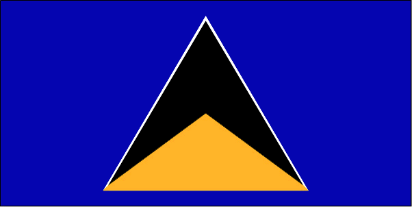
Saint Lucia
Pays
Sainte-Lucie
countryucasefr
SAINTE-LUCIE
Pays en Chinois
Pays en Espagnol
St. Lucia
Pays en Italien
St Lucia
Pays en Portugais
St. Lucia
Pays en Allemand
Str. Lucia
countrypy
sheng4 lu2 xi1 ya4
countrylocal
Saint Lucia
countryfull
Saint Lucia
countrynm
Saint Lucia
ISO2
LC
ISO3
LCA
countrycodeisono
662
countrycodevehicle
WL
countrycodeolympic
LCA
countrycodeirs
ST
countrycodeirsfr
ST
countrycodeirsmixt
ST
♀Féminin
18
6
51
languagesfr
Anglais
35
currency
dollar
currencyfr
dollar des Caraïbes orientales
currencyisocode
XCD
currencyisocodefull
XCD 951
currencypxcode
XCD
currencysymbol
EC$
currencysubdivision
100 cents
currencyregime
US-$ (2.7)
currencyvalue
0.3745
Capitale
Castries
capitalfr
Castries
Préfixe Tél.
1-758
Superficie km2
620
arealand
606
areawater
10
landarablerate
0.0492
landforestrate
0.148
coastline
158
summit
Mont Gimie 950 m.
timezonedeltabegin
-4
flaglink
maplink
lccolor.gif
outlinemaplink
lc.gif
visapassenger
-1
maincities
Vieux Fort, Dennery, Micoud, Soufrière.
largestcity
Castries
largestcitypopulation
53 000
rankpopulation
181
Population
161 000
rankgdp
165
gdp
693000000
rankgdpppp
158
gdpppp
917000000
rankgni
184
gni
650000000
rankincomeorigin
80
rankincome
88
income
4050
rankincomeppp
114
incomeppp
5310
lifeexpectation
73.34
alphabetizationrate
0.67
natalityrate
0.0205
fecondity
2.27
mortalityrate
0.00518
mortalityrateinfantile
0.01395
hdi
0.775
urbanization
0.38
nationalevent
Independence Day
nationaleventfr
Jour de l'Indépendance
nationalholiday
22 February (1979)
Date de naissance aaaa-mm-jj
1979-02-22 00:00:00
6
8
president
Reine Elisabeth II
location
Caribbean, island between the Caribbean Sea and North Atlantic Ocean, north of Trinidad and Tobago
terrain
volcanic and mountainous with some broad, fertile valleys
naturalresources
forests, sandy beaches, minerals (pumice), mineral
9
Web
rgbback
16777215
todate
1

35

id
Pays
Pays en Anglais
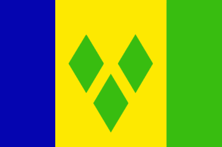
Saint Vincent and the Grenadines
Pays
Saint-Vincent-et-les Grenadines
countryucasefr
SAINT-VINCENT-ET-LES GRENADINES
Pays en Chinois
Pays en Espagnol
St. Vincent y el Grenadines
Pays en Italien
St Vincent & il Grenadines
Pays en Portugais
St. Vincent & o Grenadines
Pays en Allemand
Str. Vincent u. das Grenadines
countrypy
sheng4 wen2 sen1 te4 he2 ge2 lin2 na4 ding1 si1
countrylocal
Saint Vincent and the Grenadines
countryfull
Saint Vincent and the Grenadines
countrynm
Saint Vincent and the Grenadines
ISO2
VC
ISO3
VCT
countrycodeisono
670
countrycodevehicle
WV
countrycodeolympic
VIN
countrycodeirs
VC
countrycodeirsfr
VC
countrycodeirsmixt
VC
18
6
51
languagesfr
Anglais
35
currency
dollar
currencyfr
dollar des Caraïbes orientales
currencyisocode
XCD
currencyisocodefull
XCD 951
currencypxcode
XCD
currencysymbol
EC$
currencysubdivision
100 cents
currencyregime
US-$ (2.7)
currencyvalue
0.3745
nationalityfr
Française
Capitale
Kingstown
capitalfr
Kingstown
Préfixe Tél.
1-784
Superficie km2
389
arealand
389
landarablerate
0.1026
landforestrate
0.154
coastline
84
summit
Soufrière 1 234 m.
timezonedeltabegin
-4
flaglink
maplink
vccolor.gif
outlinemaplink
vc.gif
visapassenger
-1
maincities
Georgetown, Fancy, Chateaubelair, Layou.
largestcity
Kingstown
largestcitypopulation
27 000
rankpopulation
186
Population
109 000
rankgdp
171
gdp
371000000
rankgdpppp
163
gdpppp
668000000
rankgni
192
gni
361000000
rankincomeorigin
91
rankincome
101
income
3310
rankincomeppp
105
incomeppp
5870
lifeexpectation
73.35
alphabetizationrate
0.96
natalityrate
0.01677
fecondity
2.23
mortalityrate
0.00604
mortalityrateinfantile
0.01524
hdi
0.755
urbanization
0.56
nationalevent
Independence Day
nationaleventfr
Jour de l'Indépendance
nationalholiday
27 October (1979)
Date de naissance aaaa-mm-jj
1979-10-27 00:00:00
6
8
location
Caribbean, islands between the Caribbean Sea and North Atlantic Ocean, north of Trinidad and Tobago
terrain
volcanic, mountainous
naturalresources
hydropower, cropland
9
Web
rgbback
16777215
todate
1

Plus+
A | B | C | D | E | F | G | H | I | J | K | L | M | N | O | P | Q | R | S | T | U | V | W | X | Y | Z
 

Envoyez vos commentaires (43)

40. Visiteur *.*.35.* - 2024-12-30 20:50:31
fwaga
39. Visiteur *.*.35.* - 2024-12-30 20:50:25
fwaeae
Email Web

Veuillez recopier la chaîne :
Texte à recopier.

Asia Home™ > Indonésie > France > Porto Rico 波多黎各 => Indonésie 印度尼西亚 => Pays de Beau Bois | Conditions générales de vente | Retours et remboursements | Clauses de Confidentialité | FAQ
  

Envie de venir ? | Appelez-nous 7/704 67 79 04 87 (Service Epices)

Bonne Année 2025 ! Nouvel an Chinois Dans 17 jours !Bonne Année 2025 ! Nouvel an Chinois Dans 17 jours !
Fenêtre contextuelle    Fermer
Veuillez patienter...